Data, not Street View
How the Hop Earth map works
Hop Earth uses mapped road structure and terrain information to build a drivable scene in the browser. Think of it as generated geography: useful for exploration and route ideas, not a photographic or navigational copy of a real road.
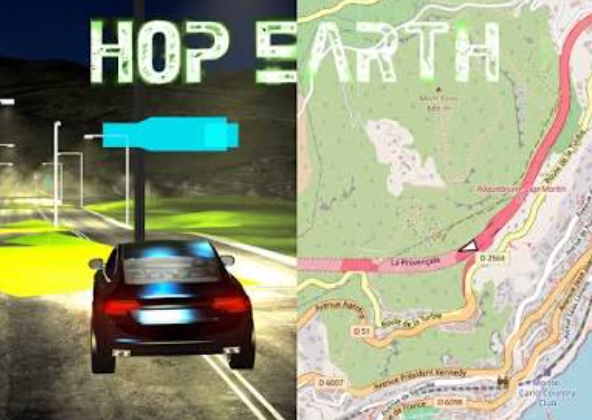
Three inputs
Three Hop Earth map layers
Road geometry
Mapped lines, connections, and road classifications provide the skeleton for a possible drive.
Elevation
Height samples help the browser turn a road line into slopes, rises, and surrounding terrain.
Generation
The live client interprets those inputs as surfaces, objects, and vehicle space.
Why a familiar road can look unfamiliar
A map database describes relationships and features, not every lane marking, curb, barrier, grade, or object a real driver sees. The game has to simplify that information, especially around tunnels, bridges, tight junctions, and stacked roads.
- A bridge can meet terrain differently from the real structure.
- Several road levels may be difficult to separate in one small area.
- A visible path may not be a practical vehicle start.
Choose locations that generate well
Begin with a connected main road, give terrain time to settle, and avoid the most elaborate interchange on your first test. A wide city avenue or ordinary coastal road gives you a better baseline than a tunnel mouth or remote path.
Read Hop Earth as generated geography, not imagery
Search by a real place, then judge what the live game creates. A route can share a direction with the real world while road width, scenery, barriers, and junction shape remain game-generated.
Understand how elevation changes the result
Roads need terrain height before they become a 3D drive. Different elevation coverage and resolution can make grade changes, coast edges, bridges, or multi-level intersections more noticeable. On a steep route, let the scene finish loading and approach unusual joins at a controlled speed.
Choose roads that are likely to generate cleanly
Connected roads with modest terrain and simple intersections are the most reliable starting places. Test a broad road first; if it works, move toward the more ambitious landmark. That keeps a difficult local feature from looking like a whole browser or account failure.
Interpret map differences responsibly
Never use a generated scene for real travel, access, safety, or current road-condition decisions. A playable connection does not prove that a real route is open, legal, safe, or unchanged.
Build a personal map-quality checklist
Check that the intended road is connected, terrain has settled, the first vehicle test succeeds, and a nearby alternate start exists. Keep a few known-good locations to compare when a new route behaves strangely.
Field notes
How the Hop Earth map works field notes
Road data is structure, not a racing surface. It helps the game understand where a connected route may exist, but it cannot guarantee a precise physical model.
Elevation is a separate variable. When a scene looks odd near a hill, bridge, or coast, test a nearby main road before changing all browser settings.
Location choice is part of the game. Use the route generator for a focused objective, then visit Missing Car only when the map is visible but a vehicle will not appear.